


Rising tide: Clemson scientists seek solutions to state’s mounting nuisance floods
May 26, 2020
While a rising tide may lift all boats, it spells trouble for South Carolina coastal communities where flooding has already long been a fact of life.
Low-lying areas such as the state’s more than 2,000 miles of coastline are increasingly prone to floods and storm surge as sea levels rise — driven by a more variable global climate system — but a team from Clemson University is leading research in the state to uncover green solutions to help those communities fight back.
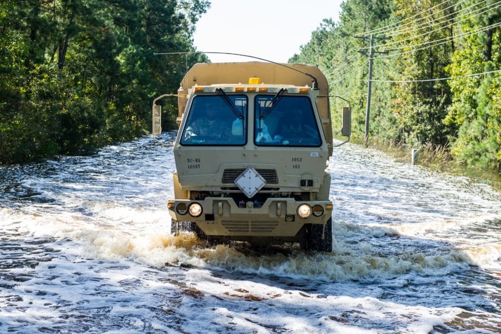
A record number of coastal flood events — 89, on at least 76 individual days — occurred along the Southeast and South Carolina coast last year, according to the National Weather Service. Image Credit: Tech. Sgt. Jorge Intiriago, S.C. Army National Guard
“In coastal South Carolina and beyond, nuisance flooding from extremely high spring or ‘king’ tides can disrupt life for residents and visitors in our communities,” said Daniel Hitchcock, an associate professor at Clemson’s Baruch Institute of Coastal Ecology and Forest Science. “These flood events are more routine than our unprecedented tropical events over the past few years. Recent large tropical events have certainly opened our eyes to potential adverse impacts and demonstrate the need for better data and predictive tools, as well as socioeconomic assessment.”
But a new grant gives researchers throughout the Southeast, including the team from Clemson led by Hitchcock, the opportunity to evaluate cost-effective infrastructure interventions for mitigating flood risks in coastal locales.
The Institute for Water and Environmental Resilience (IWER) at Stetson University is collaborating with the National Oceanic and Atmospheric Administration’s Office for Coastal Management and Sea Grant College Programs in Florida, Georgia, South Carolina and North Carolina. The research opportunity is made possible by funding from a $404,000, two-year Karl Havens Memorial South Atlantic Regional Research on Coastal Community Resilience Grant.
“The goal of the project is to assess how green infrastructure interventions — like natural land conservation and restoration of coastal wetlands, oyster reefs and beach dunes — may provide cost-effective flood mitigation within essential transportation networks,” said Jason Evans, interim executive director of IWER and the grant project’s team leader. “Each state team is working closely with its partner communities to develop project recommendations. The team works very well together because of its overall spirit of collegiality, collaboration and commitment to furthering long-term resilience of coastal communities.”
Hitchcock’s team will include Baruch Institute associates Marzieh Motallebi, an assistant professor in applied economics; Amy Scaroni, an assistant extension professor; Bo Song, an associate professor in landscape ecology; and Tom Williams, a professor emeritus in hydrology. They will conduct countywide geospatial analyses of flood hot spots and the economic effect of flooding in coastal communities. They also will work with the other three states to provide technical guidance for green infrastructure projects in the communities.
“We’re pleased to provide funding to Clemson University to support their contributions to this important regional resilience research initiative,” said Rick DeVoe, executive director of S.C. Sea Grant Consortium. “Evaluating green-infrastructure techniques for use in flood-prone areas is a critical step and we look forward to their technical guidance, which should ultimately help coastal communities with flood mitigation.”
Unprecedented storm events over the past five years have revealed the need for more accurate and readily available hydrologic information, as well as economic analysis of flood impacts and mitigation efforts. In turn, community leaders and residents need better understanding of how extreme rainfall and high tides affect access to and from communities in flooding hot spots.
With six counties that border the Atlantic Ocean and another 21 inland counties at significant risk by hurricanes and tropical storms, according to the S.C. Emergency Preparedness Division, South Carolina ranks among the most vulnerable states in the nation to be impacted by such storms.
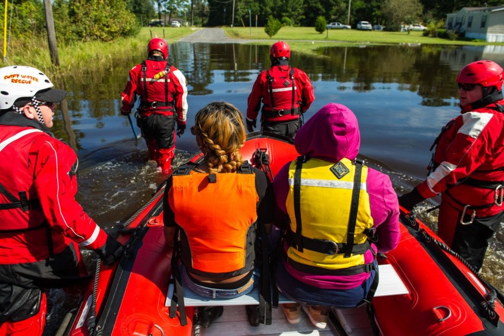
With six counties that border the Atlantic Ocean and another 21 inland counties at significant risk by hurricanes and tropical storms, according to the S.C. Emergency Preparedness Division, South Carolina ranks among the most vulnerable states in the nation to be impacted by such storms. Image Credit: Tech. Sgt. Jorge Intiriago, S.C. Army National Guard
But while the impact of extreme weather events is typically clear to see from the damage left in their wake, the increasing severity of regular tidal flood events also poses an increasing threat to Lowcountry lifestyles.
“For example, downtown Charleston floods so frequently now whether it’s raining or not — saltwater comes up through the storm drains because it has nowhere else to go,” Hitchcock said. “It’s something that is happening more routinely, and it’s just getting worse and worse with sea-level rise. People sometimes don’t realize we have a problem until it actually happens to them and you’re found in the situation where certain areas become inaccessible, whether you’re a visitor or a resident. With urban flooding, doing business in downtown Charleston becomes impossible when access is denied.”
But the state also includes numerous areas outside urban settings — barrier islands and coastal communities — such as those in Georgetown County, the study’s focus area, where sea-level rise is leading to an increased impact from flooding.
“We see it here in Pawleys Island,” Hitchcock said. “With these big storms, you can’t get out on the island. What does that do for residents? What does that do for tourism?”
Thus, Clemson’s team will focus on using Georgetown County as a test case for economic data collection in relation to flooding and storm surges. Researchers will examine using grey — or manmade — infrastructure versus green infrastructure and the associated costs to mitigate access and transportation issues.
As an example of a grey infrastructure solution, the U.S. Army Corps of Engineers proposed in April the construction of a 9-mile, 12-foot seawall around the lower Charleston peninsula to protect against potentially catastrophic storm surges during future extreme weather events. The funding needed for the project has been estimated between $1.75 billion and $2.2 billion.
The grant study, meanwhile, seeks to assess green — or natural — solutions to similar issues.
“Can we look at the economic value, in the future, of grey vs. green infrastructure?” Hitchcock said. “Are we talking about building up marshes and protective flood plan areas and using green infrastructure to be able to manage this flooding? It becomes an economics question – is there a potential cost benefit to that? Or do we need to make the causeways higher? Do we need to go in and knock out bridges and build elevation onto these causeways to be able to improve access?”
Partner communities also include Cape Canaveral, Florida; Garden City, Georgia; and the City of New Bern and New Hanover County, North Carolina. The cities and counties will be working with the lead researcher in their respective state to identify specific project sites for possible green infrastructure interventions, as well as to develop cost-benefit analysis models for providing a range of estimates for long-term values, including flood protection, habitat creation and preservation, contaminant mitigation and the integration of green spaces within a built environment.
“This specific project is really more about infrastructure and access to places, whether it’s kids who have to go to school, parents who have to go to work, or people that need emergency services. Of course, tourism is potentially heavily impacted, because flooding keeps visitors away or may impact their stay, such as preventing them from going to dinner and spending money in restaurants and shops,” Hitchcock said. “So, it’s really all about the evaluation of the impacts of nuisance, routine flooding in these types of areas, whether it’s urban, barrier islands, marshes or other upstream coastal property and real estate.”